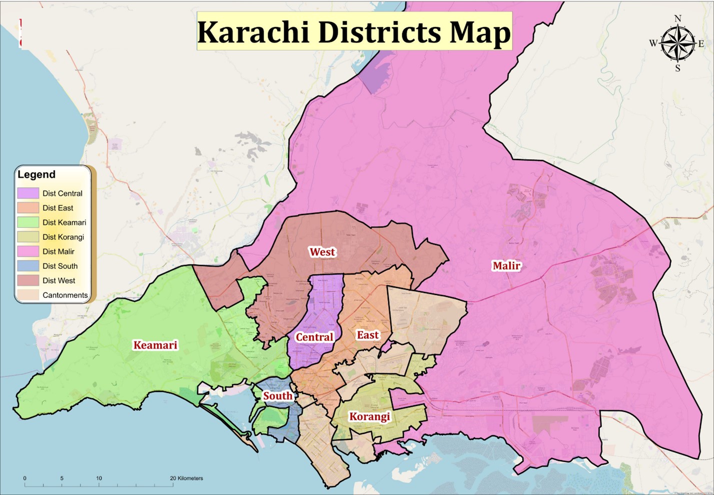
Karachi is Pakistan's largest city and is the capital of Sindh; it lies on Pakistan's southern coast, on the Arabian Sea just northwest of the Indus River Delta. Karachi is built on a coastal plain with scattered rocky outcroppings, hills and coastal marshlands. Originally a tiny fishing village, Karachi became a trading center in the 18th century. Today, it is one of the largest and rapidly growing cities globally. The Karachi Division is spread over an area of 3527 Area(km2) which is further subdivided in to 07 districts and 31 subdivisions.
| Administrative Area | Area (km2) | Population | Map | |||
|---|---|---|---|---|---|---|
| District | Sub Division | District | Sub Division | District | Sub Division | |
| District Central | Gulberg | 69.00 | 14.00 | 3,822,325 | - | Map |
| Liaquatabad | 6.00 | - | ||||
| Nazimabad | 8.00 | - | ||||
| New Karachi | 18.00 | - | ||||
| New Nazimabad | 23.00 | - | ||||
| District East | Ferozabad | 139.00 | 20.00 | 3,950,031 | - | Map |
| Gulshan-e-Iqbal | 29.00 | - | ||||
| Gulzar-e-Hijri | 79.00 | - | ||||
| Jamshed Quarters | 11.00 | - | ||||
| Karachi South | Arambagh | 122.00 | 4.00 | 2,329,764 | 237,224 | Map |
| Civil Lines | 73.00 | 480,480 | ||||
| Garden | 4.00 | 502,820 | ||||
| Lyari | 6.00 | 949,878 | ||||
| Saddar | 35.00 | 159,362 | ||||
| Karachi West | Mango Pir | 370.00 | 342.00 | 2,679,380 | Map | |
| Mominabad | 19.00 | - | ||||
| Orangi Town | 9.00 | - | ||||
| Keamari | Baldia | 559.00 | 34.00 | 2,068,451 | Map | |
| Harbor | 50.00 | - | ||||
| Maripur | 450.00 | - | ||||
| SITE | 25.00 | - | ||||
| Korangi | Korangi | 108.00 | 59.00 | 3,128,971 | - | Map |
| Landhi | 19.00 | - | ||||
| Model Colony | 9.00 | - | ||||
| Shah Faisal | 21.00 | - | ||||
| Malir | Airport | 2160.00 | 41.00 | 2,403,959 | - | Map |
| Bin Qasim | 447.00 | - | ||||
| Gadap | 1104.00 | - | ||||
| Ibrahim Hyderi | 97.00 | - | ||||
| Murad Memon | 195.00 | - | ||||
| Shah Mureed | 276.00 | - | ||||